
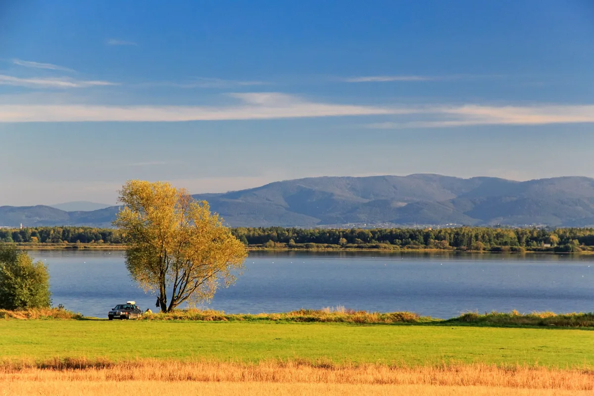
Goczałkowice Lake is a dam reservoir on the Vistula, created in 1956. It has a maximum surface area of 3200 hectares and a capacity of about 168 million cubic metres. It is managed by the Upper Silesian Waterworks Company (Górnośląskie Przedsiębiorstwo Wodociągów), and the reservoir provides 38 per cent of that company's treated surface water. It is therefore not a bathing place but a facility that one walks around from a distance.
Does it lie entirely in the Silesian Voivodeship
Yes. The whole reservoir lies within the boundaries of the Silesian Voivodeship, but it is built on a former border. The lake covers Upper Silesian lands, that is Pszczyna County, and Cieszyn Silesia, that is Bielsko and Cieszyn Counties, and its creation flooded the historical border between them. In 1954, before the flooding, the area planned for the reservoir was incorporated into Pszczyna County, and it was assigned wholly to the municipality of Goczałkowice-Zdrój only after the reform of 1973. That is why the municipality today reaches across the lake as far as Strumień. Neighbouring localities, such as Chybie or Zabrzeg, also lie in the Silesian Voivodeship.
Construction and resettlement
The first mentions of the need for a reservoir on the upper Vistula appeared before 1918. The idea of building a reservoir in Silesia was proposed in the 1920s by Gabriel Narutowicz. After the war the subject returned because of the development of the Upper Silesian Industrial Region and the looming water deficit. Studies lasted from 1947, the project was approved at the end of 1949, and construction lasted from 1950 to 1955.
Construction required the resettlement of about 2000 inhabitants from 428 private farms in the area of Zarzecze. The owners could choose to build new houses themselves from materials salvaged from demolition, or take replacement farms. According to the same source the construction was carried out in haste under political pressure: before flooding the reservoir basin was not thoroughly cleared, and the old flood embankments and concrete bunkers from the Second World War were not removed.
It is worth clarifying that Zarzecze did not vanish from the map. The village exists to this day as a village council area (sołectwo) of the municipality of Chybie on the southern shore of the lake, only much smaller. According to data from 1996 it had 335 hectares, 74 houses and 331 inhabitants, which was one sixth of the area, one fifth of the buildings and one ninth of the inhabitants of the former, large Zarzecze. A considerable part of the village was therefore under water, not the whole of it. Accounts of the building of the reservoir link the resettlement with Zarzecze and do not name any other village flooded entirely.
Birds
Studies from 1983-2004 confirmed 258 bird species at the reservoir or in its immediate surroundings, including 113 breeding species. Among the rare and threatened ones are the ferruginous duck, the purple heron, the pied avocet and terns. In 2002 the avocet raised here its second successful brood in Poland and the first in southern Poland. During migration large concentrations of birds gather: the great cormorant up to 2 thousand, the bean goose from 500 to 4000, and the mallard as many as several tens of thousands. The reservoir lies in a Natura 2000 area, and in 2004 a special bird protection area, the Upper Vistula Valley, was created.
Where you can approach
Entry to the reservoir area is prohibited. For pedestrians and cyclists the crest of the dam, 2980 metres long, has been opened as a walking section between Goczałkowice-Zdrój and Zabrzeg. Local authorities have sought to open the lake for recreation, but the reservoir's manager does not agree to this.
At the entrance to the dam operates the Technical Education Centre, an educational park on meteorology, astronomy, the dam and renewable energy. One can add to this the spa Spa Park in Goczałkowice-Zdrój or travel to Pszczyna, where the bison reserve awaits, a few kilometres from the dam. Check the rules of access to the shores with the manager.
Be the first! Add a comment.
You need to log in to add a comment.
Log in