
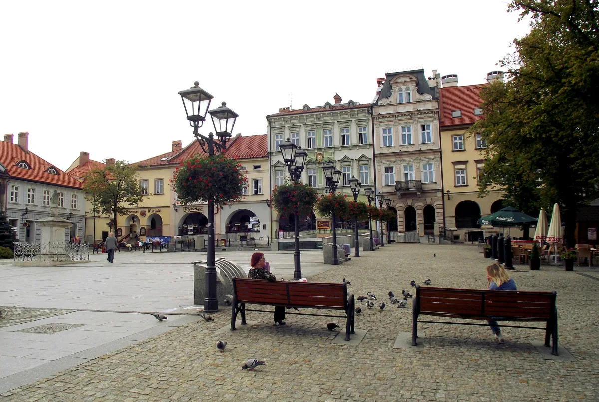
Bielsko-Biała has a hyphen in its name, and it is not a decoration. For more than six centuries there were two separate towns here, facing each other on the two banks of the small river Biała. They formally merged on 1 January 1951, but traces of the division can still be found today: in the layout of the squares, in the style of the tenement houses, and in which side of the river a given town hall stands on.
A river that was a border
The Biała is about 28.6 km long, of which 14 km flows within the limits of the present town. For centuries it separated two towns, and at the same time two states and two lands. Around 1315 it marked the border between the Duchy of Cieszyn and the Duchy of Oświęcim. After 1457, when the Duchy of Oświęcim was bought by the Polish king Casimir IV Jagiellon, it became the border between the lands of the Bohemian Crown and the Kingdom of Poland. From 1772 it divided Austrian Silesia from Galicia, and in 1920-1939 the autonomous Silesian Voivodeship from the Kraków Voivodeship.
Bielsko lay on the left bank, in Cieszyn Silesia, and is first mentioned as a town in 1312. Biała, on the right bank, is much younger: it arose in the 16th century as a small craftsmen's settlement, and received town rights on 9 January 1723. Despite their different state affiliation the two towns were similar to each other, because in both German-speaking people, Lutheranism and cloth-making predominated. For this reason the German collective name Bielitz-Biala was already in use in the 19th century.
Bielsko: the town on the hill
The older part of the twin town begins on a hill. The Market Square (Rynek) is a rectangle measuring about 80 by 60 metres, laid out at the foundation under German law and unchanged in shape since the early 14th century. The buildings date mainly from the 18th and 19th centuries, because the greatest influence on the present appearance came from the rebuilding after the great fires of 1808 and 1836. Two streets leave from each corner of the square, which is typical of medieval Silesian towns.
The newer heart of Bielsko is Bolesław Chrobry Square, colloquially called Pigal. It took shape from the mid-19th century, when tenement houses began to appear around the square and a new avenue connected it with the railway station, and it gradually competed with the old-town market square. It is closed off to the south by the castle of the Sułkowski princes, which has a separate article in the portal. In the old suburbs of Bielsko lies also Martin Luther Square, the centre of the quarter called Bielsko Zion. After Emperor Joseph II's Patent of Toleration of 1781 a Protestant church and schools were built here, and in 1900 the Luther monument was put up, the only one of its kind in Poland.
Another square of old Bielsko is Franciszek Smolka Square, the former Lower Market (Dolny Rynek). By the river and the mill races Bielsko's textile industry began here: the oldest manufactory, the dye works of Johann Christoph Ditzius, was created by the square in 1720. When the factories moved further out, Art Nouveau tenement houses appeared in their place, and today it is a busy junction where it is mainly the façades that are worth looking at.
Biała: the town on the road
On the other side of the river the layout is different, because Biała grew along a road. Wojska Polskiego Square is the former market square of Biała, laid out in 1723. In the 1780s, during the building of the Central Galician road, a new market square was laid out next to it, today's Wolności Square, and the old one was from then on called the Old Market Square. The road, a section of which is today's 11 Listopada street, is still the town's main pedestrian promenade. After the rebuilding of 2021-2023 Wojska Polskiego Square is entirely a pedestrian zone, and its hallmark remains the Art Nouveau Pod Żabami (Under the Frogs) tenement house of 1903.
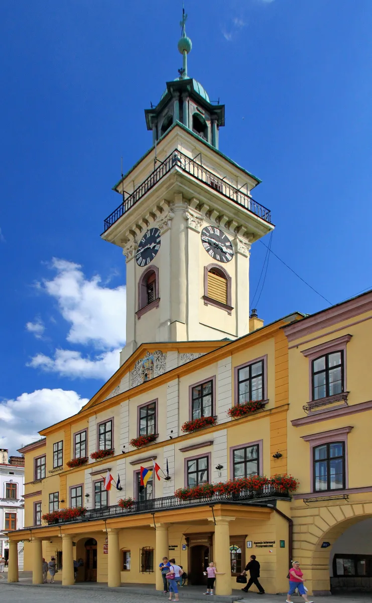
Biała acquired its own seat of authority: Town Hall Square (Plac Ratuszowy) with the Neo-Renaissance town hall of 1897, designed by Emanuel Rost Jr. Around it stand former cloth factories, now occupied by offices of the town council.
A town of textile workers
What joined the two banks was above all work. The year 1806, when machine spinning frames were started up in eight manufactories, is regarded as the beginning of industry in the twin town, and in the 19th century the region became one of three centres of textile making in Austria-Hungary, alongside Brno and Liberec. Traces of that world can be seen at close quarters. The Stara Fabryka (Old Factory) by Żwirki i Wigury Square is housed in the former Büttner textile factory of 1887 and shows the history of the town's industry and historic cloth-making machines. The Weaver's House (Dom Tkacza) on Sobieskiego street, in turn, is a wooden house and workshop of the 18th century, described as a unique example of craftsmen's architecture that disappeared in the town's fires of 1808 and 1836.
Parks provided a rest from the factories. The Textile Workers' Park (Park Włókniarzy) was founded in 1899 as the Planty Blichowe, and received its present name after the war. Juliusz Słowacki Park was created a year earlier on the site of a former cholera cemetery and still houses the Music House (Dom Muzyki), the former seat of the marksmen's fraternity, dating from 1831.
The seam of 1951
The two towns were first joined, paradoxically, by the occupation: the German administration made Biała into the district of Bielitz-Ost. A lasting merger came only on 1 January 1951, when a town of about 60 thousand inhabitants was created. The river flows on, and the former division is now recalled mainly by the squares, town halls and tenement houses on both sides of the current.
Be the first! Add a comment.
You need to log in to add a comment.
Log in