
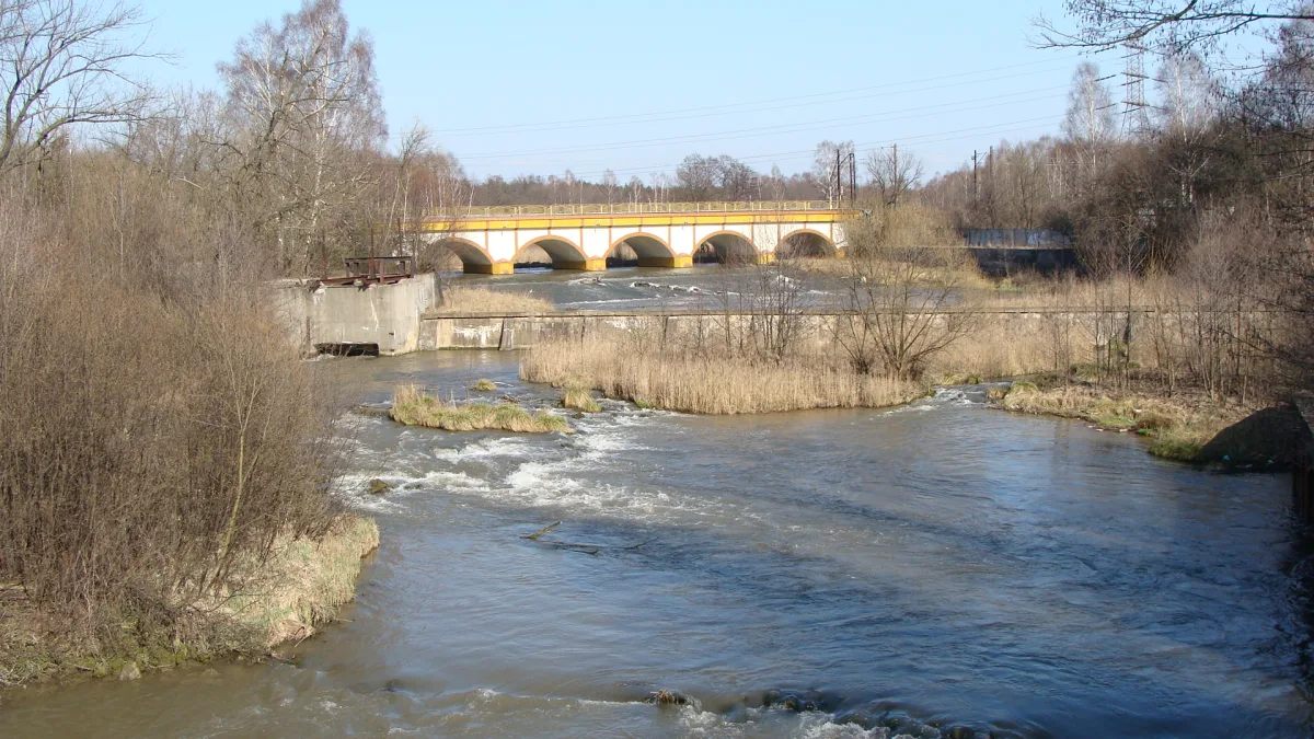
Where the rivers form the Przemsza
The Three Emperors' Corner is a river confluence: the Biała Przemsza flows here into the Czarna Przemsza, and from this point the river is simply called the Przemsza. Before 1915 the borders of three empires ran along these three channels: the German (earlier Prussian), the Austrian and the Russian. Today the former tripoint lies on the territory of two towns. On the Prussian, later German side, Brzęczkowice and Słupna bordered it, today districts of Mysłowice. On the Russian side lay Modrzejów and Niwka, and on the Austrian side Jęzor, today districts of Sosnowiec. Another triangle-shaped area, whose southern vertex lies in Modrzejów, is sometimes mistakenly identified with the Corner itself.
How the borders shifted
A river as a border has a long history. After the Prussian-Austrian war in 1742 the Czarna Przemsza separated Prussia from the Duchy of Siewierz, which was a fief of Poland. After the partitions and the Peace of Tilsit in 1807 the arrangement of borders settled on the Czarna Przemsza. After the Congress of Vienna in 1815 the frontiers of the Kingdom of Poland, Prussia and the Free City of Kraków met here. Only after Kraków was incorporated into the Habsburg monarchy in 1846 did three powers meet here. This date is taken as the beginning of the tripoint.
The end came in 1915, when Germany and Austria-Hungary occupied the Kingdom of Poland. After 1922 at the same place only the borders of three Polish voivodeships met: Silesian, Kraków and Kielce.
Where the name Dreikaisereck comes from
The German name Dreikaisereck, that is the Three Emperors' Corner, appeared after the unification of Germany in 1871, and caught on after 1873, when the Three Emperors' League was concluded. Earlier the place was referred to as Drei Länder Ecke, the Corner of Three Countries. The Polish word trójkąt (triangle) is said to be a mistaken calque: a mental shortcut from the German Dreieck. These findings need confirmation in sources, so this is a description of the tradition of the name, not a ruling by linguists.
The railway and a bridge on the border
The border was also marked by the railway. Mysłowice gained a railway connection with Wrocław in 1846, and with Kraków in 1847. A trace of that era has survived in Maczki, on the border of Sosnowiec and Jaworzno. The stone, six-span railway bridge over the Biała Przemsza was opened in 1848. The station in front of it was originally called Granica (Border), and the bridge linked the Congress Kingdom, part of the Russian Empire, with the Austrian Empire.
A place known from postcards
Until the First World War the tripoint was known almost throughout Europe. Newspapers wrote that between 3 and 8 thousand tourists visited it each week. Two small excursion steamers sailed here, and in the border stalls one could do some shopping. The attraction was the trip itself across the border bridges, because just beyond the border cultural and economic differences were visible. On postcards the portrait of the German emperor was placed in the place of honour, and the other two in more modest positions.
A view from height was provided by the Bismarck tower on Słupecka Górka, opened on 20 October 1907. After the plebiscite it was called the Insurgents' Tower, then named after Tadeusz Kościuszko. Sources give the date of its demolition as 21 August 1933, according to others 1937. Stone from the demolition was used to build the steps of the Katowice cathedral and the church of Our Lady of Sorrows in Brzęczkowice, at whose parish the Missionary Museum in Mysłowice operates today.
After 1945 and the surroundings
After the Second World War the place fell into oblivion. It was recalled after Poland joined the European Union, when the mayors of Mysłowice, Sosnowiec and Jaworzno met here. On the Sosnowiec promontory stands an obelisk from 2007 with an inscription about the former division of Europe and its unification, made from a granite slab of a dismantled monument. The plaque on the Mysłowice side was changed, because the earlier inscription spoke of three partitions, and during the partitions Silesia belonged to German states. After the change it speaks of the borders of three states.
The area is worth combining with other places on the Przemsza. The Three Emperors' Corner has its own entry with a description of how to get there. On the Sosnowiec bank of the Czarna Przemsza runs the Czarna Przemsza Boulevard, and next to it lies Schön Park. The cycle route of the former borderland leads through the Piaszczyste Doły (Sandy Pits).
In Mysłowice itself the history of the town is told by the Mysłowice City Museum, and next to it is the Central Fire Service Museum. A reminder of the Mieroszewski family, the town's former owners, are the Castle Park and Mieroszewskich Square.
Be the first! Add a comment.
You need to log in to add a comment.
Log in