
Silesia is associated with mines and steelworks, but from a dozen or so places in the region you can look down on it in an entirely different scene: on the bends of the Oder, the ponds of a nature reserve, the Beskid ridges or the plain of the Racibórz Basin. Below we have gathered the towers and viewing platforms that have their own entries on the portal. They fall into three groups: towers in the mountains, towers on the lowlands of the south-western part of the voivodeship, and places where there is no tower but there is a view.
Silesian Beskids: from the cable car to wooden platforms
The easiest to reach is the viewing tower by the cable car on Szyndzielnia. It is 18 metres high and was opened on 14 August 2015. It stands by the upper station of the gondola lift, which has run to the summit from Bielsko-Biała since 1953 and was thoroughly modernised in 1994-1995 and 2017. The mountain itself is 1029 metres above sea level, and just below the summit, at 1001 metres, stands a PTTK mountain hut built in 1897. So you can ride up, climb the tower and walk down to the hut without planning a full-day trip.
The viewing tower on Stary Groń in Brenna has an entirely different character. It was built below the summit and is 12 metres high. Stary Groń (791 metres) is the name of both the peak and a narrow ridge almost three kilometres long running off from Grabowa. The black trail from Brenna to Grabowa follows the ridge. In the clearings grow some of the richest sites of purple foxglove in Poland, and the first shepherd's hut was set up here in the first half of the 17th century.
Near Wisła stand two small wooden structures looking towards Lake Czerniańskie. The Szarcula viewing tower is located by the pass of the same name, in the Silesian Beskids Landscape Park. The year of construction and the height of this tower have not been confirmed in the available sources, so before setting out it is worth checking these details at a tourist information office. On the summit of Kubalonka (830 metres) stands the Kubalonka viewing tower. It is a low timber lattice construction with a roof and one platform, reached by a ladder. Access is by the yellow trail from the Szarcula pass. The data on the tower date from 2022, so the current condition of the structure should be checked before setting out.
Racibórz Basin and surroundings: towers in a flat landscape
In the south-west of the voivodeship towers do not need high mountains, because the terrain is flat and even a dozen or so metres make a difference. Some of them are linked by the Silesianka trail, described as a trail of viewing towers and platforms. Some sources place it in the Upper Oder Land, others in the Silesia Euroregion.
The viewing tower in Pogrzebień stands on a hill 291 metres above sea level, in the southern part of the village. It is a metal pyramid-shaped structure, opened in 2019, 19.72 metres high, with three platforms at heights of 3.21, 6.42 and 9.21 metres. From the terraces you can see, among other things, Tworków and Bieńkowice, the Racibórz Dolny reservoir, the Szarlota spoil heap in Rydułtowy, and further away the Beskids (Szyndzielnia and Równica), the Sudetes and the Jeseníky with Praded.
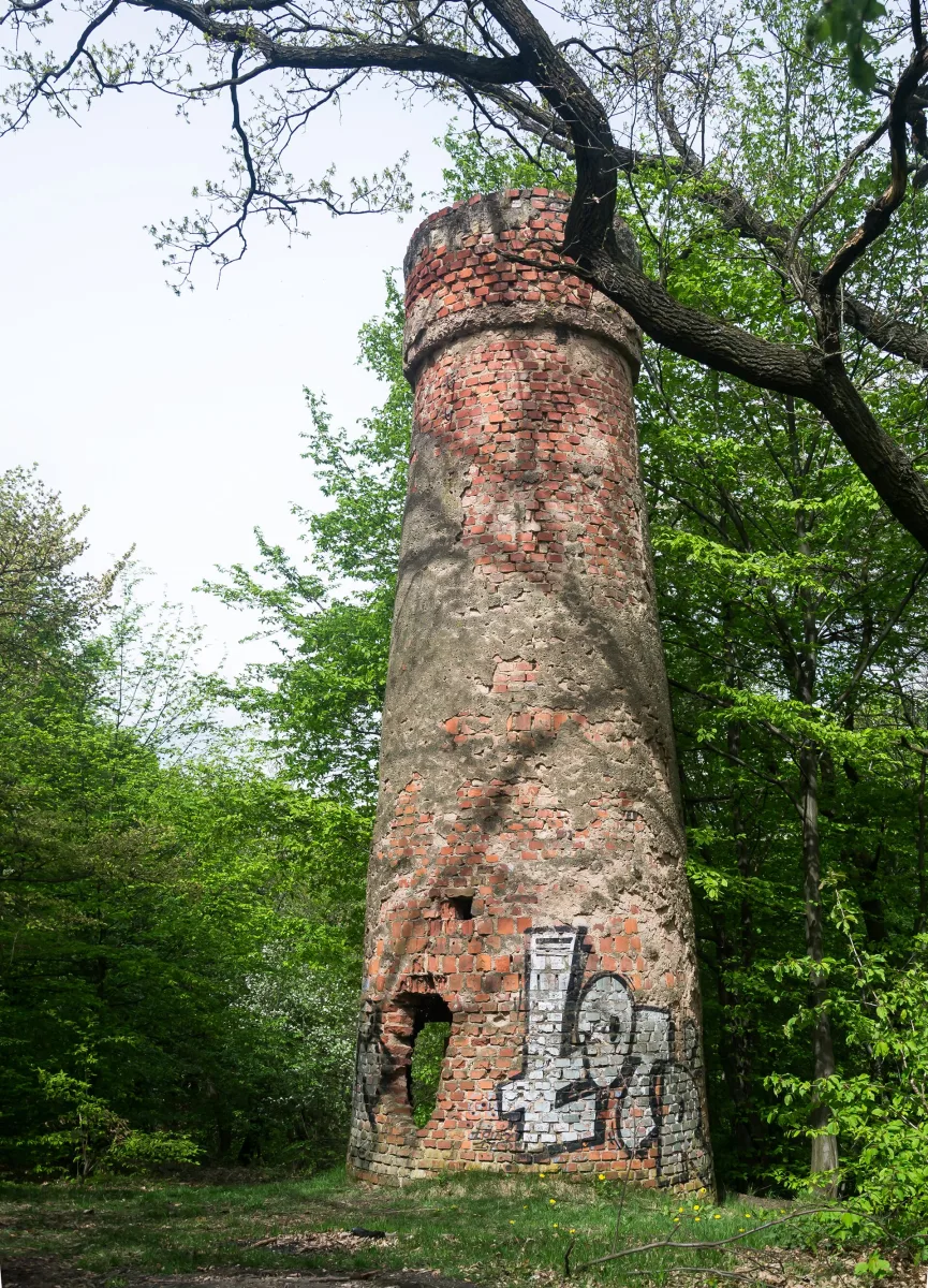
The Romantic Tower in Wodzisław Śląski, also called the Knights' Bastion, is a Neo-Gothic brick structure about 20 metres high. It was built in 1867-1868 in the town forest on Grodzisko, and its founder was Edward Brauns, then owner of the town. The tower was renovated in 1991, burned down in 2004, and its reconstruction lasted from 2012 to 2021. Since 2021 the viewpoint has been open to visitors as part of the Silesianka project. The structure is entered in the heritage register.
On the border with Czechia, in Chałupki, stands the Border Meanders of the Oder viewing tower. From it you look at a stretch of the river valley about seven kilometres long, from the former Chałupki-Bohumín border crossing to the mouth of the Olza, at an altitude of about 193-198 metres. On the Polish side the area covers 162 hectares and was established on 29 October 2004, while on the Czech side it is a natural monument of 126.36 hectares. Two nature trails begin by the tower.
For birds and panorama lovers
The viewing platform on Salm Duży is a wooden observation tower in the Łężczok reserve, near Nędza. According to the description of the reserve, it was built in 2017 and also serves as a covered bird observation point. Salm Duży is one of the eight ponds of the reserve, alongside Ligotniak, Brzeziniak, Babiczak, Grabowiec, Tatusiak, Markowiak and Salm Mały. The ponds have existed since the 13th century, and extensive fish farming is carried out on them. It is worth bringing binoculars, because the platform lets you look from above and from hiding.
Not far away, on the edge of the Moravian Gate Arboretum in Racibórz-Markowice, lies the Markowice Panorama. It is a viewpoint without a tower, on the edge of the town forest Obora. The view reaches over the buildings of Markowice, dominated by the Neo-Gothic church of St Hedwig of Silesia, then to the forests of the Łężczok reserve, the Racibórz Basin and the hills of the Głubczyce Plateau. A board with a description of the view stands on site.
Without a tower: a rock and a mound
Two sites from the same category on the portal have no towers and do not promise panoramas, but it is worth knowing about them when planning a trip. Malinowska Skała is a peak 1152 metres high in the main ridge of the Barania Góra and Skrzyczne range, and also a rock outcrop about 60 metres north of the summit. Since 1977 the outcrop has been a natural monument of inanimate nature. At the summit the boundaries of Wisła, Szczyrk and Lipowa meet, and the border between Lesser Poland and Silesia runs across the peak.
The border mound in the fields of Syrynia, Grabówka and Lubomia is a historic embankment, most probably heaped up anew in 1793-1794. At its foot lies a stone with the date 1822 and the inscription “Lipa Zofii”. A local legend says that the mound was made of earth thrown by Swedish soldiers as a farewell, but this is folk tradition, not an established fact. The sources do not describe the view from the mound, so we treat it as a local curiosity, not a viewpoint.

Be the first! Add a comment.
You need to log in to add a comment.
Log in