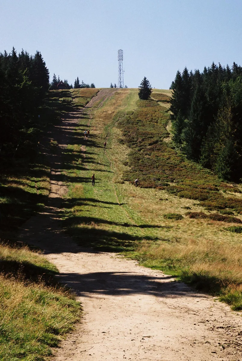
A peak of 1,117 m above sea level in the Silesian Beskids, along which runs the border of Bielsko-Biała and Szczyrk, with a PTTK mountain hut 700 m away.
Klimczok (1,117 m above sea level) is a peak in the Klimczok and Szyndzielnia Range in the Silesian Beskids. The administrative border between Bielsko-Biała and Szczyrk runs over its summit, as does the former historical border between Silesia and Lesser Poland. The junction of ridges and the crossing of trails mean that many routes across the Beskids pass this way.
The name comes from a brigand of the Żywiec-Silesian borderland named Klimczok, and it attached itself to the mountain in the Romantic era. At the beginning of the 19th century it was still called Goryczna Skałka (Bitter Rock) or simply Skałka.
The older name arose because just below the summit, on the western slopes, there extends a system of ridge trenches and rock fissures. They contain small caves, the largest being 26 m long. According to local tales it was said to be the hideout of the brigand of the title. On the slopes there are also the Ali Baba Cave in Klimczok and the Two-storey Cave in Klimczok.
The summit is shaped like a mound with a rounded top, and the slopes falling towards the valleys of the Białka, the Wilczy Potok and the Barbara are steep and covered with beech and spruce forests. On the north-eastern slopes lie the sources of the Białka.
On the summit stands a steel mast with relay antennas. Until the end of the 1970s there was a wooden triangulation tower here, from which a considerable part of the Western Carpathians could be seen. The tower is no longer there, and growing trees limit the view to the south-eastern sector, where above the ridges of the Żywiec Beskids the peaks of the Tatras can be seen.
Of the plants rare in Poland, the Moravian monkshood grows here. Within the boundaries of the Biła forest district there is a group of trees exceeding 45 metres in height, and one Douglas fir at the beginning of 2018 was about 57 metres tall (the result depends on the method of measurement) and about 115 years old.
The average annual temperature on the summit is 5-6 °C, precipitation reaches 1,300 mm a year, and a snow cover about 220 cm thick lasts for about 125 days, from early November to early May. A record cover of 305 cm was recorded on 14 March 1993. For a trip you should take rainwear.
The Klimczok PTTK mountain hut stands 700 m east of the summit, at an altitude of 1,052 m above sea level, between Magura and the Siodło pass. The first wooden building, called Klementynówka, was built on the Magura ridge in 1869 for hunters. The present one, built of stone, dates from 1914 and has survived to this day with minor changes. Next to the Klimczok PTTK Mountain Hut there is a 430 m ski drag lift.
At the Kowiorek pass, between Klimczok and Magura, walking trails cross to Szczyrk, Bystra, Brenna to the Salmopol Pass, to the Karkoszczonka pass, to Szyndzielnia and to Błatnia.

Be the first! Add a comment.
You need to log in to add a comment.
Log in