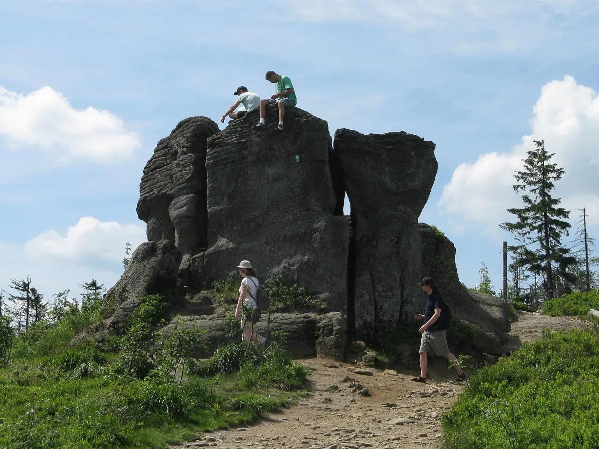
A conglomerate outcrop by the trail just below the summit of Malinowska Skała in the Silesian Beskids, an inanimate natural monument since 1977.
Malinowska Skała is two things under one name: a peak 1,152 m above sea level in the main ridge of the Barania Góra and Skrzyczne Range in the Silesian Beskids, and a rock outcrop right by the trail, about 60 m north of the summit. It is the outcrop that is the main point here, and at the same time one of the best-known symbols of the Silesian Beskids.
The outcrop has the shape of a fragmented pulpit measuring 6 by 14 by 5 m. It is made of Upper Cretaceous conglomerate: a fine- and medium-grained quartz conglomerate with fragments of mica schists, granites and feldspar grains. This type of rock occurs only in the Silesian Beskids, the Little Beskids and the Moravian-Silesian Beskids, in the highest part of the upper Godula beds. Weathering forms can be seen on the walls, including a fairly deep niche.
Since 1977 the outcrop has been protected as an inanimate natural monument. Earlier it was used for bouldering. Photographs of it appeared in regional guides to these mountains and on postcards, and today this is the most common reason why tourists climb onto this ridge.
At the summit the boundaries of three localities meet: Wisła, Szczyrk and Lipowa. The border between the historical regions of Lesser Poland and Silesia also runs through Malinowska Skała. The Żywiec reeve Andrzej Komoniecki recorded in the early 18th century that the boundary of the so-called Żywiec state ran through the peak, which he called Skałka.
The streams Malinka and Malinowski Potok and the river Żylica rise below the summit. On the western slopes of the ridge towards Skrzyczne, at an altitude of about 1,030 m above sea level, lies a natural, year-round small pond, rare in the Beskids, about 10 m across, called Malinowski Stawek.
Trails lead to Malinowska Skała from several sides.
Below Malinowska Skała there is also a small cave, Jaskinia Malinka, with passages 16 m long, discovered in 1979.

Be the first! Add a comment.
You need to log in to add a comment.
Log in