
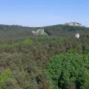
A four-kilometre range of limestone hills near Kroczyce, with Zborów Hill, the Głęboka Cave and Jura trails.
The Kroczyce Rocks (Skały Kroczyckie) are a range of hills in the central part of the Częstochowa Upland, west of Kroczyce in Zawiercie County. They stretch for about 4 kilometres from Dzibice Reservoir in the north to provincial road no. 792 from Żarki to Kroczyce. The hills are covered with forest, but in many places limestone outcrops reach the surface.
From north to south they are Słupsko, the 405 m hill, the 420 m hill, Łysak (Jastrzębnik), Popielowa Hill, Pośrednia Hill, Kołoczek and Zborów Hill. The last two are the most popular with tourists and climbers, and the Zborów Hill nature reserve was created on them. The rocks are a favourite place for rock climbing.
At the foot of the Double Tower (Dwoista Baszta) lies the Głęboka Cave, the only cave in the northern part of the Jura open to tourists. There are also other caves and rock shelters closed to visitors. On Słupsko hill there are two archaeological sites: an early medieval hillfort and a prehistoric camp from the Middle Palaeolithic.
From the top parts of some of the rocks you can see the castle in Morsko and further castles in Bobolice, Mirów and Ogrodzieniec. The range belongs to the Natura 2000 site Kroczyce Refuge (Ostoja Kroczycka). Rare plant species grow in the forests, among them orchids, and the rocks hold valuable xerothermic grasslands and heat-loving vegetation.
Two main Jura trails run through the hills, the Trail of the Eagles' Nests and the Trail of the Jurassic Strongholds, along with the Zamonit Trail and cycling and skiing routes.

Be the first! Add a comment.
You need to log in to add a comment.
Log in