
Silesia, Silesian Voivodeship
Thursday, 05 November 2026 PL / EN

Great views: Tarnowskie Góry

For families For couples Solo For rainy days Free
3 attractions
Mountains
Miners' Trail
Tarnowskie Góry

a 26 km yellow trail from the Tarnowskie Góry adit through Miasteczko Śląskie to a lake

Mountains
Segiet Trail
Tarnowskie Góry

black PTTK trail from Segiet through the historic silver mine to Pniowiec, 12.3 km

Scenic views in Tarnowskie Góry come down to a forest lake, Głęboki Dół, and two PTTK hiking trails: the yellow Miners' Trail and the black Segiet Trail.

This short selection suits visitors who want quiet nature in and around the town rather than a guided tour. Two entries are walking trails and one is a small lake in the woods, so everything fits into a single walk or several shorter ones.

Where to go for views in Tarnowskie Góry?

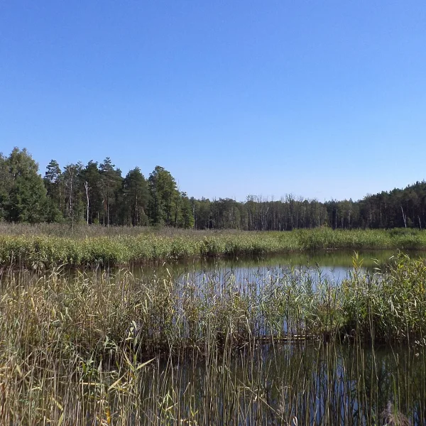
The calmest spot is Głęboki Dół, a small lake in the Lubliniec Forests covering about 3.8 ha, in the Pniowiec district near the border with Miasteczko Śląskie. Dense reeds line the shore and the Graniczna Woda stream flows through it.

For a longer outing there are two marked trails. The Miners' Trail is a yellow PTTK route of about 26 km: it starts at the Black Trout Adit, runs through Miasteczko Śląskie to Lake Nakło-Chechło and ends in Kolonia Woźnicka. The Segiet Trail is black and 12.3 km long. It links Segiet with the Historic Silver Mine, the Market Square and Tarnowskie Góry railway station, and ends in Pniowiec. The history of the mining town along both routes is covered in an article on the Historic Silver Mine.

Frequently asked questions

Which trail in Tarnowskie Góry is longer?

The Miners' Trail, at about 26 km. The Segiet Trail is 12.3 km. Both are walking routes marked by PTTK.

Are the views in Tarnowskie Góry free?

Entry to all three places is free. For more like them, see the category of scenic views in Silesia.