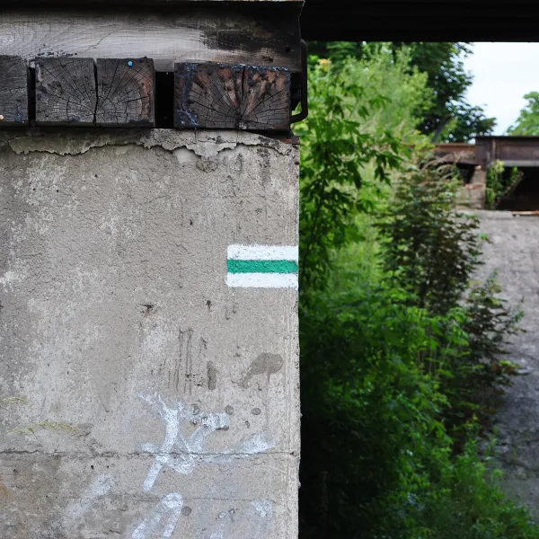
Scenic views in Katowice: seven walking trails through forests, parks and valleys, from short strolls to full-day routes.
PTTK looks after them, and they differ mainly in length and starting point. Some begin in a park in the middle of the city, others by a railway station or a leisure centre. Green trails from across the region are gathered in Piękne widoki, and the overview of the city leads through the page Katowice.
Which trail should you pick when you have only a few hours?
A few hours are enough for three routes of up to seven kilometres: the Wesoła Fala, Park and Murcki Valley trails. Two of them end in the same valley in Murcki.
The shortest is the Wesoła Fala Trail, a green stretch of roughly 2.7 km leading from Murcki to Mysłowice-Wesoła. It also serves as a link between larger routes. The Park Trail is around 4.2 km and ties together two municipal parks, Kościuszko and the Forest Park, and passes the Zgrzebnioka and Muchowiec estates on the way. It starts next to the church of St Michael the Archangel.
A little longer is the Murcki Valley Trail, black, 6.8 km. It leaves the Bolina centre in Janów, passes Giszowiec and Stara Wesoła, which already lies in Mysłowice, and finishes in the valley that gave it its name.
Which trail gives you a full day outdoors?
Four routes suit a whole day: Ochojec, Walking, Żwaków and the 25th Anniversary loop. You can divide the first three into stages, because railway stations stand at the start or on the way.
The Ochojec Trail is a way from Ochojec in Katowice to Lędziny, about 17-18 km long. The Katowice Ochojec station shows the approach to the start. The route passes a floristic reserve, then the forests of Murcki, and goes on past Płone Bagno with Kamienna Góra to reach Lędziny-Zamoście.
The Katowice Walking Trail carries blue marks and runs about 24 km. Its start lies in Chorzów, in a large recreation park, and it soon passes the Silesian Planetarium. Then it crosses Dąb, Koszutka and Śródmieście to emerge at Hamerla, near Trutowisko. If you want to see how the conurbation changes from north to south, this route is for you.
Much longer is the Żwaków Trail: 35.5 km from Katowice Piotrowice station, through Żwaków, Panewniki and Mikołów, to Tychy-Paprocany. In Panewniki a basilica stands by the route, and Mikołów has the Basilica of St Adalbert. You will not walk such a route unprepared, so split it into two stages.
The widest reach belongs to the green loop of the 25th Anniversary of the PTTK Trail, about 115 km. It leaves Katowice behind and circles the conurbation, joining eight cities, among them Będzin, Sosnowiec and Jaworzno. On the way you meet the Pogoria lakes and St Dorothy's Hill.
How do you tell the trails apart in the field?
Each trail has a stripe on a white background, and the colour identifies the route. Green are the Wesoła Fala Trail and the 25th Anniversary loop, blue is the Katowice Walking Trail, and black are the Park, Murcki Valley, Ochojec and Żwaków trails. Before a longer trip plan where you will board a train at the end of the day.
Frequently asked questions
Which trail should you begin with on a first walk?
A good choice is the Park Trail: around 4.2 km between Kościuszko Park and the Katowice Forest Park. It needs no journey beyond the city.
Which way leads across the whole conurbation?
Choose the blue Katowice Walking Trail or the green 25th Anniversary loop. The first leads from Chorzów through Katowice, the second circles eight cities.
How do you reach the start of the Ochojec Trail?
It is best to walk to the start from the Katowice Ochojec railway station. The route ends in Lędziny.
Does it cost anything to walk these trails?
No, the trails are marked by PTTK and can be walked free of charge.

 Mountains